In the digital forensics world, a single photograph can make or break a case. But when EXIF metadata has been stripped, altered, or was never there to begin with, how do investigators verify the authenticity and location of digital evidence?
The answer lies in advanced geolocation techniques that go far beyond simple metadata extraction. Modern digital forensics demands a multi-layered approach combining AI analysis, visual intelligence, and reverse engineering methodologies.
The Limitations of EXIF Data in Legal Investigations
EXIF (Exchangeable Image File Format) data has long been the first stop for investigators analyzing digital images. This metadata can contain GPS coordinates, camera model, timestamp, and other valuable information. However, relying solely on EXIF data presents critical vulnerabilities:
EXIF data is easily manipulated. Anyone with basic photo editing software can alter or remove metadata entirely. Social media platforms automatically strip EXIF data from uploaded images, making it unavailable for verification. In legal proceedings, manipulated metadata can lead to false conclusions or inadmissible evidence.
Chain of custody concerns arise when metadata is the only verification method. Defense attorneys routinely challenge EXIF-based evidence, questioning whether the data has been tampered with or whether the image was taken at the claimed location and time.
Criminal actors increasingly understand how to remove digital fingerprints. Sophisticated perpetrators know to disable location services, use burner devices, or process images through metadata-stripping tools before sharing them.
For these reasons, modern investigators must employ visual geolocation verification techniques that analyze the actual content of images rather than relying on potentially unreliable metadata.
Visual Geolocation: Reading the Story Within the Image
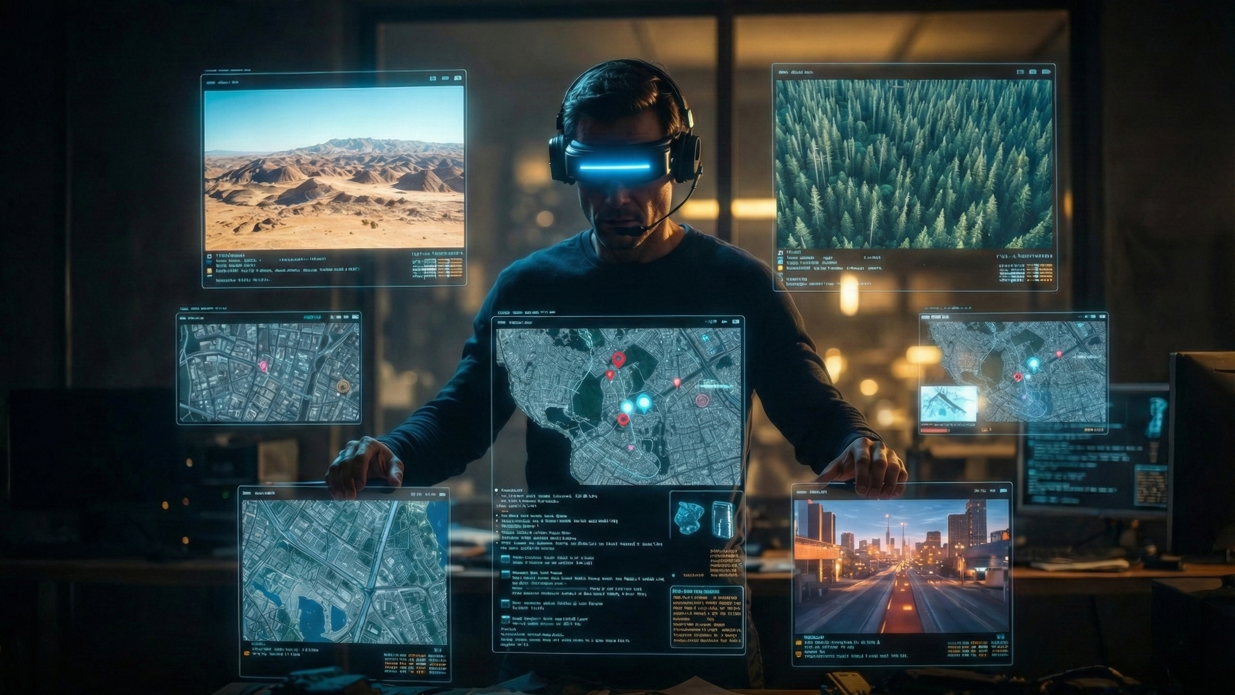
When EXIF data fails, the image itself becomes the primary source of location intelligence. Advanced geolocation tools like GeoSeer use Large Vision-Language Models (LVLMs) and AI agents to extract location clues that human analysts might miss or take hours to identify.
Architectural Analysis
Buildings tell stories about their location through distinctive architectural styles, construction materials, and design patterns. AI-powered systems can identify regional building characteristics including roof styles common to specific areas, building materials that indicate geographic origin, window designs and placement patterns unique to certain regions, and architectural elements that reflect local building codes or cultural preferences.
A case example demonstrates this approach: investigators analyzing footage from a fraud case identified the location despite stripped metadata by recognizing a specific combination of Soviet-era panel construction with modern European energy-efficient windows—a pattern common only in certain Eastern European cities that underwent recent renovation programs.
Environmental and Botanical Clues
The natural environment provides remarkably specific location indicators. Vegetation types, growth patterns, and seasonal states can narrow down geographic regions significantly. AI systems trained on botanical databases can identify plant species visible in images and cross-reference them with climate zones and geographic distributions.
Sun angle and shadow analysis offers another powerful verification method. By calculating shadow lengths and directions, investigators can determine the approximate time of day and latitude where an image was captured. When combined with visible vegetation and weather patterns, this creates a multi-factor verification system that's extremely difficult to falsify.
Infrastructure and Urban Planning
Every region has distinctive infrastructure signatures. Road marking styles, traffic signs, utility pole designs, and street furniture follow regional or national standards. Power line configurations, telecommunications infrastructure, and even the style of street drainage systems can indicate specific geographic areas.
In one notable case, investigators verified the location of surveillance footage by identifying a specific combination of traffic light mounting style, road surface material, and pedestrian crossing design that was unique to a particular city's recent infrastructure upgrade program.
Text and Signage Analysis
Visible text in images provides multiple verification vectors. Language and script analysis can immediately narrow down potential locations. Shop names, business types, and commercial signage reflect local economic patterns and cultural preferences. License plate formats, street signs, and regulatory notices follow jurisdictional standards.
AI-powered optical character recognition combined with geolocation databases can identify not just what signs say, but what their presence indicates about a location's commercial zone classification, demographic makeup, and regulatory environment.
The GeoSeer Approach: Multi-Agent AI Analysis
Modern geolocation verification requires processing multiple complex visual cues simultaneously—a task that AI agents excel at. GeoSeer employs a multi-agent architecture where specialized AI components analyze different aspects of an image concurrently.
The architectural analysis agent examines building styles, materials, and construction patterns. The environmental analysis agent evaluates vegetation, terrain, climate indicators, and natural features. The infrastructure agent identifies roads, utilities, telecommunications equipment, and urban planning signatures. The text analysis agent processes all visible writing, signs, and symbolic content. The synthesis agent combines findings from all specialized agents to generate location hypotheses ranked by confidence level.
This approach doesn't just identify possible locations—it provides investigators with a confidence score and detailed reasoning for each hypothesis, creating documentation that can withstand legal scrutiny.
Creating Verifiable Digital Evidence
For evidence to be admissible in legal proceedings, investigators must demonstrate a clear methodology and chain of reasoning. AI-powered geolocation tools like GeoSeer generate detailed analysis reports that document every visual clue identified, the reasoning process used to interpret those clues, confidence levels for each finding, and alternative hypotheses considered and why they were ruled out.
This level of documentation transforms geolocation analysis from subjective interpretation into reproducible forensic science. When an investigator testifies about image location verification, they can present a comprehensive report showing exactly how the conclusion was reached.
Real-World Applications in Digital Forensics
The applications of advanced geolocation verification extend across numerous investigative scenarios. In fraud investigations, verifying that images were taken at claimed locations can prove or disprove alibis. For intellectual property cases, geolocating images can establish where trade secret violations occurred or where counterfeit products were manufactured.
Insurance fraud investigations frequently rely on image verification to confirm whether claimed damages occurred at insured locations. Human trafficking and exploitation cases use geolocation to identify where illicit content was produced, enabling rescue operations and prosecutions. War crimes documentation requires precise location verification to establish where atrocities occurred and who had control of those areas.
Best Practices for Investigators
To maximize the effectiveness of visual geolocation verification, investigators should capture and preserve original image files immediately, document the source and acquisition method thoroughly, conduct analysis before examining any metadata, use multiple verification methods to cross-confirm findings, and maintain detailed records of the analytical process.
The golden rule of digital forensics applies: never rely on a single verification method. Visual geolocation analysis should complement, not replace, traditional forensic techniques.
The Future of Digital Evidence Verification
As image manipulation technology becomes more sophisticated, the importance of robust verification methods only increases. Deep fake technology and AI-generated images present new challenges for investigators, making advanced analysis capabilities essential.
The next generation of geolocation tools will need to not only identify where images were taken but also detect whether they've been manipulated or artificially generated. This requires combining visual geolocation with image authenticity analysis—both areas where AI and machine learning excel.
Conclusion
When EXIF data cannot be trusted, the image itself becomes the evidence. Modern investigators need tools that can extract and analyze the hundreds of visual clues contained in every photograph, conducting in minutes the analysis that would take human experts hours or days.
GeoSeer's AI-powered approach to visual geolocation provides investigators with the verification capabilities needed for modern digital forensics. By combining multiple specialized AI agents with comprehensive visual analysis, it delivers location verification that stands up to legal scrutiny while dramatically reducing investigation time.
In an era where digital evidence is central to most investigations, having robust, defensible geolocation verification isn't just useful—it's essential.
Interested in learning how GeoSeer can enhance your investigative capabilities? Contact us for a demonstration of AI-powered geolocation verification.